May 2020, a so‑called “1-in-20-year” catastrophic flood—though in fact the 5th in the past 20 years—triggered by a cyclone (※1) struck Bangladesh. Furthermore, in early August during the monsoon (※2) rainy season of continued precipitation, 1/3 of the country was inundated, more than 5.5 million people were affected, over 1.05 million households were flooded, and more than 145 people died. In Bangladesh, the twin blows of flood damage and the economic slowdown caused by COVID-19 have pushed about 1/3 of the population into poverty.
In this article, we look at what lies behind the severe flooding in Bangladesh and what measures are being taken.
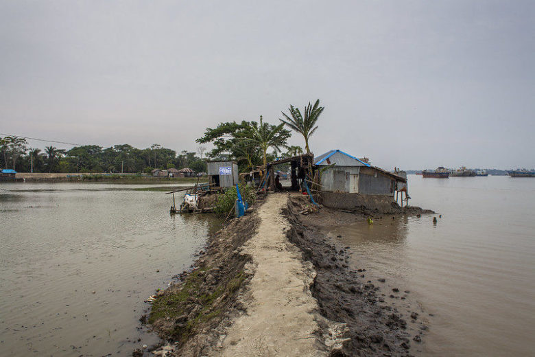
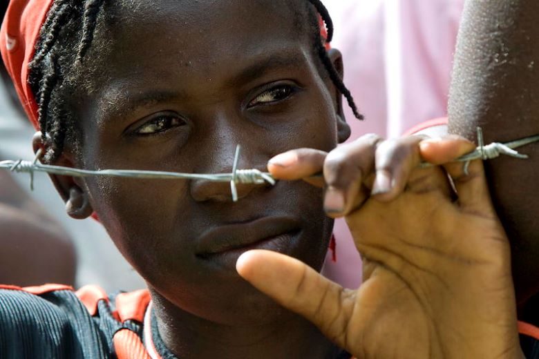
Area passed by a cyclone (Photo: UNWomen / Flickr [CC BY-NC-ND 2.0])
目次
What is happening in Bangladesh
Floods that strike Bangladesh fall broadly into four patterns: river overflow, heavy rainfall, storm surges, and flash floods. The most common are floods caused by river overflow. Bangladesh has 230 rivers, including 57 international rivers, and when water levels on the three major rivers—the Ganges, Brahmaputra, and Meghna—rise simultaneously during the rainy season, nationwide major floods are likely to occur. Floods caused by rainfall are seen from June to November during the rainy season in the delta region (※3) of southwestern Bangladesh, including urban areas. Floods due to storm surges occur mainly in association with cyclones along the approximately 800 km coastline. Floods caused by flash floods (※4) result from short periods of intense rainfall and similar events.
Traditionally, Bangladesh has experienced periodic inundation during the rainy season, and floods have also had the benefit of creating fertile farmland. However, over the past half century, multiple major floods affecting 50–70% of the country have been observed, adversely impacting people’s lives. For example, the powerful cyclone that struck Bangladesh in May 2020 forced more than 2.4 million people in coastal areas to evacuate. Homes, embankments, sanitation facilities, fields, and livestock were also affected, with total damages estimated to exceed 11.5 billion US dollars.
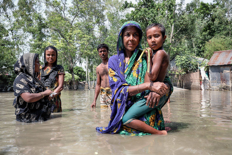
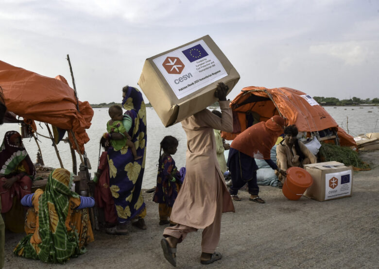
People who lost their homes in the floods (Photo: UN Women/Flickr [CC BY-NC-ND 2.0])
Moreover, the human toll from floods is not limited to direct causes such as drowning. As floods expand the number and range of disease vectors like mosquitoes, illnesses such as dengue and malaria increase, and using contaminated water for daily needs raises the risk of infectious diseases as well. In addition, the mass displacement of people driven from their homes by flooding can heighten the risk of outbreaks of infectious diseases, including COVID-19.
Causes of frequent floods and severe damage
Why, then, does Bangladesh suffer such extensive flood damage? To answer this, we must first understand its unique geography. Bangladesh, located in South Asia along the Bay of Bengal, has a monsoon climate influenced by strong seasonal winds, with rainfall concentrated in the wet season from June to September. It is also situated in the path of cyclones that form in the Bay of Bengal. Furthermore, much of the country lies on the vast Ganges Delta formed by the Ganges, Brahmaputra, and Meghna rivers; 2/3 of the land is at an elevation of 5 meters or less above sea level, and even the capital, Dhaka, is only 8 meters above sea level—making it a low-lying country. For these geographical reasons, Bangladesh has long been susceptible to flooding.
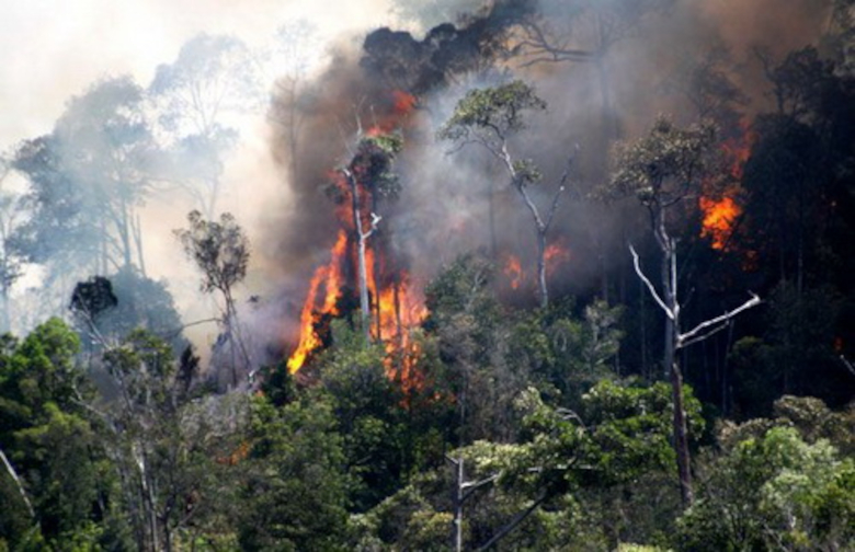
In recent years, various additional factors have compounded the problem. One is deforestation in India (upstream of rivers flowing through Bangladesh) and within Bangladesh itself. In these areas, population growth has accelerated logging to meet rising demand for food and fuelwood. Forest loss upstream leads to soil erosion and landslides during monsoon rains, in turn causing downstream flooding. Bangladesh also has a high population density of about 1,126 people per square kilometer, and rapid urbanization—such as building housing and roads on former farmland—is underway to accommodate a still-growing population. Urbanization shortens the time before drainage systems are overwhelmed during heavy rainfall, thereby increasing flood risk. Other factors include reduced downstream flow due to dams and other structures, which slows rivers and promotes sedimentation that lowers channel storage capacity, and topsoil loss from cultivation that further lowers land elevation.
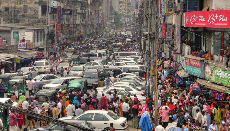
Scenes from the capital, Dhaka (Photo: joiseyshowaa/Flickr [CC BY-SA 2.0])
For these reasons and more, Bangladesh is considered one of the countries most vulnerable to climate change. Some forecasts suggest that by 2050, climate impacts could create 13.3 million internally displaced people, with damage expected to worsen. In recent decades, Bangladesh has been plagued by a variety of anomalies—unpredictable monsoons, abnormal rainfall, more intense cyclones, sea-level rise, and higher river levels due to snowmelt in the upstream Himalayas—whose major driver is climate change. Although Bangladesh accounts for only 1% of global greenhouse gas emissions that cause climate change, high-income countries—primarily responsible for those emissions—have shifted the burden onto low-income countries.
Those who bear the brunt of flooding
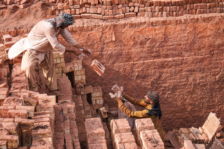
Within Bangladesh, the burden also falls on low-income people. As seen in the fact that more than half of the population lives on $3.1 per day or less, the country has faced serious poverty. People living in poverty often must continue living in flood-prone areas without adequate measures even after being hit by floods, or if they move to cities, they often end up in low-income neighborhoods instead. With little income, food shortages and price spikes caused by flooding can push them into malnutrition, further worsening living conditions. Farmers—who make up roughly 50% of the population and are largely in poverty—are particularly hard-hit by floods because agriculture takes place in fertile yet high-risk floodplain areas. Traditionally, Bangladeshi agriculture has relied on fertile land created by monsoon flooding, but the large and frequent floods of recent years have made traditional farming methods difficult. Farmers who used to cope by moving when fields were inundated during the monsoon now must move more frequently, and saltwater intrusion is changing soil conditions, reducing the land available for farming.
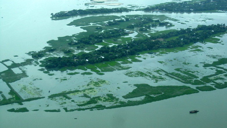
Bangladesh seen from above (Photo: Mohammad Tauheed/Flickr [CC BY-NC 2.0])
Women can be said to suffer disproportionately from flood impacts compared to men. Historically in Bangladesh, women have not had equal participation with men in decision-making and have tended to receive lower wages on average. As a result, they may be less able to prepare for floods or rebuild their lives afterward. There is also a gender gap in access to information necessary for preparedness and recovery. Women’s mobile phone ownership is 49%, compared with 83% among men, and their internet access rates are also lower. Furthermore, amid loss of livelihoods such as agriculture and tailoring and displacement due to destroyed homes, the number of women being trafficked is rising.
Children in Bangladesh are also major victims of flooding. As of August 2, 2020, 135 people had drowned, 70% of whom were children, and it is projected that 1.3 million children will be affected by flooding in 2020. There are concerns that children will suffer harm from drowning, infectious diseases, and accidents at evacuation sites that are not adequately safe. More broadly, drowning accounts for 42% of deaths among children aged 1 to 4 in Bangladesh. Behind this are circumstances where parents must work or do housework while daycare is scarce, leaving no appropriate supervisor or nearby adult able to rescue them. Repeated evacuations and damage to facilities due to floods also deprive children of educational opportunities.
Measures against floods: “flood control” or “adaptation”?
Various measures have been taken to address flood damage in Bangladesh. Among response measures from domestic and international actors focusing on post-flood risk reduction are housing support for those who lost their homes and financial assistance for displaced people, which have been provided. Public health measures such as chlorination of water for daily use and improved handling of corpses have also been proposed.
For long-term disaster risk reduction, there are two broad approaches: “flood control” to minimize the occurrence of floods, and “adaptation” to reduce damage when some flooding does occur. Flood-control measures include dredging of rivers (excavating the riverbed to remove sediment and deepen the channel), and building embankments and canals. In Bangladesh, since the 1960s—when the need for flood countermeasures became pressing—the government has led projects to construct embankments, drainage channels, and dams known as Flood Control, Drainage and Irrigation (FCDI) projects. Subsequently, flood-control measures were adopted as core policies in the “BWFMS” (Bangladesh Water and Flood Management Strategy, 1996) and the “NWMP” (National Water Management Plan, 1999) as well.
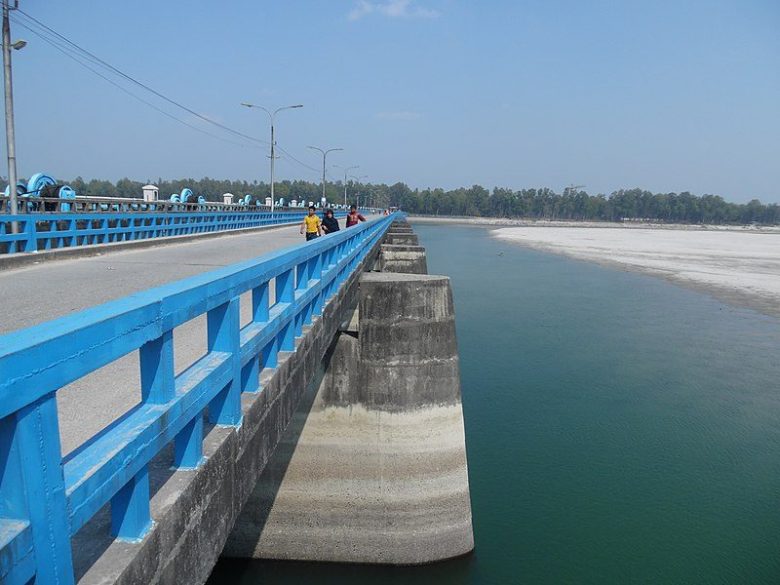
A bridge that also serves as a barrage built on the Teesta River, a tributary of the Brahmaputra (Photo: Salim_Khandoker/Wikimedia Commons [CC BY-SA 4.0])
However, flood-control approaches face problems such as enormous costs and time required to install and maintain large-scale infrastructure, and the risk that failures—or the infrastructure itself—could cause even more severe damage, as has been noted. In practice, there have been cases where embankments built high on both banks raised water levels and prevented drainage from functioning, and cases where residents built homes on parts of completed embankments, weakening them. Since it is impossible to build embankments in every potentially flood-prone area, installing them in some areas increases flood risk in others, leading to regional disparities and even conflict.
Despite these problems, flood-control measures have been promoted in part due to reliance on technical and financial assistance from international organizations and foreign countries. Technologies accumulated abroad do not necessarily suit Bangladesh’s floods. Even though risks like those above were raised regarding foreign-funded embankment projects, the Bangladeshi government is said to have chosen embankment projects that could attract more overseas funding.
What about measures to adapt to floods? Recognizing the limits of flood-control approaches from the 1960s onward, the Bangladeshi government has pursued adaptation alongside flood control by building cyclone shelters and establishing flood early warning systems, among other efforts undertaken. A warning system to disseminate cyclone approaches and flood forecasts was launched in 1970, and after several upgrades now delivers alerts via mobile phone text messages, among other means. While not all residents benefit equally, these measures have already saved many lives. In agriculture, research institutes nationwide are also working on developing salt-tolerant varieties of rice and other crops.
There have also been efforts supported by the UK to shift from rice cultivation to aquaculture such as shrimp and crab, as well as polder agriculture and a cooperation program with the Netherlands—another delta country—to share knowledge and technology. However, all of these projects raise concerns about dependence on foreign support and whether they can continue to adapt to Bangladesh’s rapidly changing environment.
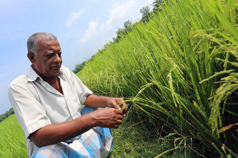
A farmer growing a newly developed rice variety (Photo: IAEA Imagebank/Flickr [CC BY-NC-ND 2.0])
The need to understand Bangladesh’s current situation
Flooding in Bangladesh is rapidly worsening, and it is clear there are limits to both “flood control” and “adaptation.” Climate change—primarily caused by high-income countries—is driving the increasingly severe annual floods. Moreover, raising domestic income levels is essential for disaster risk reduction and preventing secondary impacts, but unfair trade led by high-income countries in the textile and garment industries for fast fashion squeezes Bangladesh’s economy, leaving insufficient funds to address floods. In this way, a structure of “climate apartheid” is taking shape, in which high-income countries impose burdens on low-income countries.
Within Bangladesh, where low-income people are more affected by climate change, the situation itself reflects a “climate apartheid” structure and serves as a microcosm of a world in which low-income countries suffer more in responding to climate change—making it vitally important to understand Bangladesh’s predicament. Today, even considering only coastal flooding (from large waves and storm surges), 171 million people worldwide are exposed to flood risk; the crisis facing Bangladesh is one the entire world faces. Alongside emergency and development assistance for Bangladesh, we must address unfair trade practices that hinder flood countermeasures and economic growth there, and tackle climate change—the driver exacerbating floods.
※1: Cyclone: While the term can refer to low-pressure systems in general, here it refers to tropical cyclones in the northern Indian Ocean (such as the Bay of Bengal and the Arabian Sea) that have developed maximum instantaneous wind speeds of at least 17 m/s. Cyclones that mainly track northward over the Bay of Bengal cause damage in Bangladesh. Compared with Myanmar, India, and Sri Lanka along the Bay of Bengal, Bangladesh has a tendency to be struck more frequently by large cyclones.
※2: Monsoon: Winds with characteristic directions depending on the season; also called seasonal winds. In a broad sense, the rainy season accompanied by these winds is called the monsoon. In Bangladesh, monsoons bring concentrated rainfall in summer, with very little rain in winter.
※3: Delta: A depositional landform of sand and gravel transported by a river, formed near a river’s mouth; also called a “triangular delta.” The Ganges Delta is formed by three rivers whose catchment area is more than 12 times the area of Bangladesh, and the amount of sediment is about 2 billion tons per year—three great rivers forming a delta of unparalleled scale worldwide.
※4: Flash flood: A phenomenon in which river water levels rise rapidly due to localized heavy rain, causing the flow to surge as if a dam had burst.
Writer: Yumi Ariyoshi
Graphics: Yumi Ariyoshi
![]()


.jpg)
バングラデシュの現状がこんなにも悲しいことに驚いたと同時に、洪水の恐ろしさ・気候変動の問題を改めて認識することができました。ただ単に洪水の問題だけではなく、それにまつわる他国の影響・女性の地位の問題など、包括的に分析しておりとても分かりやすかったです!
バングラデシュの洪水の状況が、単なる自然災害ではなく、いくつもの要素が複雑に絡み合った問題であることを知ることができました。気候アパルトヘイトの構造そのもので、多角的な対策が必要だと感じました。